 Contact us
 Log in
The Foodbank Hunger Map
The Foodbank Hunger Map is a dynamic map that provides a picture of food insecurity in Australia. This is something that has never been done before to this level of detail.
How have we achieved this?
The Map is built on the foundation of the Vulnerable Australia model created by The Art of More, which uses over 8,000 data points to identify the likelihood of someone being food insecure by area and severity. Using this map, we can see where food insecurity exists, where food relief is currently going and where support is still needed right down to the suburb level.
The Foodbank Hunger Clusters
There are a lot of different reasons why people experience food insecurity. Hunger Clusters have been created to give more insight into who is food insecure, why and where they are located. To read more please see the latest Foodbank Hunger Report.
What is it used for?
The Map will be used to help us understand food insecurity better and how to achieve zero hunger in Australia.
View of the Foodbank Hunger Map
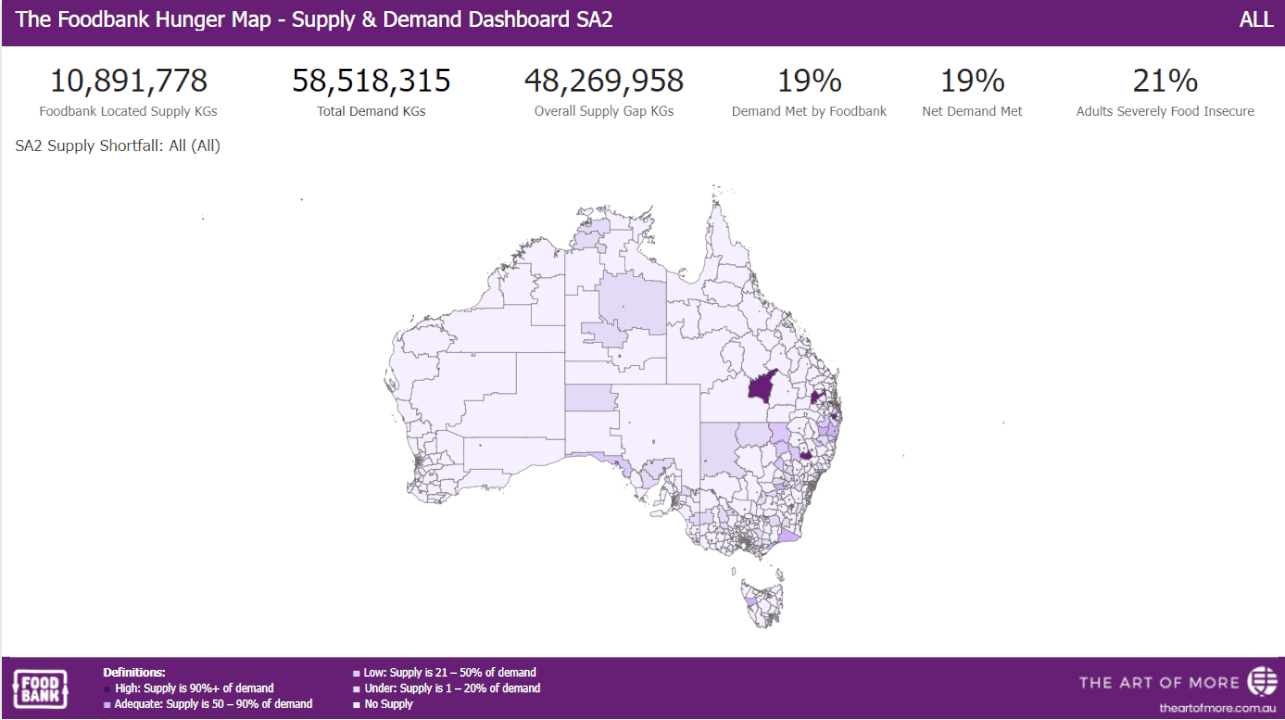
Insight into the Foodbank Hunger Map
For more information, please contact research@foodbank.org.au